Article Written by:
Yvonne Barkley, University of Idaho Extension, Moscow, ID

It is important to determine the burn severity of a wildfire as many post-fire assessment and management decisions will be based on this information. Plant mortality, regeneration and reproduction are closely tied to how hot and how long a wildfire burns and will determine the make-up of post-fire plant communities. Burn severity also effects wildlife habitat, changes in the soil, erosion potential and many components of aquatic environments.
Determining Burn Severity
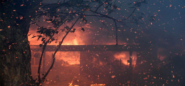
Be very careful when first entering burnt areas. Trees with partially burnt trunks and root systems, called hazard trees, are common and can fall without warning.
Before you begin, review your management objectives and existing records. An inventory of damages will be easier if you already have records of pre-burn conditions and characteristics of your land. Photographs are a valuable part of management plans and should be updated any time a change has occurred on the landscape. Establishing photo points on your property helps you compare conditions and changes over time.
You will most likely have a mosaic of burn severities throughout a burned area. Read through the categories in Table 1 before starting your assessment. You will need to consider multiple indicators in order to be able to accurately determine the burn severity for a given area. Once you have determined the severity for a given section of ground, place it on a map of the area.
Mapping Burn Severities
Using a topographic map of your area, determine and map burn severities. Indicate areas of low (green), moderate (yellow), and high (red) burn severities using the criteria provided in Table 1.
To begin:
- The information you gather will be more manageable if you assess your land by unit. Units are areas similar in landform and vegetative communities. Delineate units on a topographic map of your land. Make several copies of unit maps, as you will have different types of information beside burn severity to collect.
- Color-coding information can make interpreting your maps easier:
- green for areas with low burn severity,
- yellow for areas with moderate burn severity,
- red for areas with high burn severity.
- When you are through, photocopy all but your base-map onto clear acetate. You can then overlay the maps and see where areas of greatest concern are, as well as use them to look for patterns and compare characteristics and differences.
Table 1. Burn Severity Classifications
For surface organic horizons (litter, humus and rotten wood on forest floor)
-
-
- LOW SEVERITY – surface litter is scorched, charred, blackened but with definable plant parts; 40 to 85 percent litter cover remains.
- MODERATE SEVERITY – surface litter is partially consumed; less than 40 percent litter cover remaining, much covered with black char.
- HIGH SEVERITY – no surface litter remains.
-
For small woody debris (downed woody debris <3 inches in diameter)
-
-
- LOW SEVERITY – surfaces are burned with some unburned areas.
- MODERATE SEVERITY – surfaces are charred; some woody debris partially to wholly consumed.
- HIGH SEVERITY – small woody debris is fully consumed.
-
For large woody debris (downed woody debris >3” diameter)
-
-
- LOW SEVERITY – surfaces blackened with unburned areas.
- MODERATE SEVERITY – surfaces are all blackened; char goes into wood.
- HIGH SEVERITY – only large, deeply charred logs are left.
-
For stumps
-
-
- LOW SEVERITY – stumps are intact but blackened.
- MODERATE SEVERITY – stumps are burned deep enough to form charcoal.
- HIGH SEVERITY – stumps are gone; holes in ground where stumps and root systems were.
-
For mineral/bare soil and ash
-
-
- LOW SEVERITY – exposed soils unchanged or blackened, with isolated areas that are gray to orange where downed logs burned.
- MODERATE SEVERITY – black, gray, and/or orange soil dominates area, with little to no unburned areas; gray ash is present in patches covering <20 percent of area.
- HIGH SEVERITY – black, gray and orange soil dominates area; gray ash layers may be deep and extensive.
-
Once you have determined and mapped the burn severities for a unit you can use Table 2 to see what the indications are for a variety of forestland components and adjust your management objectives and actions accordingly.
Table 2. Burn Severity Indications
For soil organisms
-
-
- LOW SEVERITY – soil microbes and organisms are intact.
- MODERATE SEVERITY – soil microbes and organisms are absent except in isolated areas.
- HIGH SEVERITY – few to no soil organisms remain.
-
For nutrient status
-
-
- LOW SEVERITY – unaffected.
- MODERATE SEVERITY – some volatilization of nitrogen has occurred.
- HIGH SEVERITY – nitrogen is likely absent; some to little of other nutrients present.
-
For water repellant soil layers
-
-
- LOW SEVERITY – none likely.
- MODERATE SEVERITY – water repellent layers possible.
- HIGH SEVERITY – water repellant layers likely.
-
For erosion potential
-
-
- LOW SEVERITY – low.
- MODERATE SEVERITY – erosion is possible on susceptible soils/slopes.
- HIGH SEVERITY – area is susceptible to overland flows and catastrophic erosion events.
-
Additional information on this topic is provided in the following articles:
- Assessing Forestland Conditions After a Wildfire
- Predicting the Mortality of Trees and Shrubs after a Wildfire
For more information on determining burn severity after a wildfire go to After the Burn: Assessing and Managing Your Forestland after a Wildfire (pgs. 33).